| At
the start of the 20th. century, the area we know as Higley Flow
consisted of the Raquette river and running through pasture land and
marshes, partially fed by Cold Brook Flow and Warm Brook Flow.
Those huge trees we see on our shores are actually "new growth'.
The timber industry had cut the larger trees
and the only sizeable stand left was around Warm Brook Flow, in what
was to become 'Stump Bay'. Stump bay was actually a surveying error. That land was supposed to be above the flood plain, so the trees were not cut. Once the dam began to fill Higley, those trees were soon under water and a large bay was born. After the bay was created, crews were allowed to cut the trees in winter, leaving the submerged stumps behind. They're a navigational hazard, but the lack of motorboats makes bathing at the State Park more enjoyable. |
 |
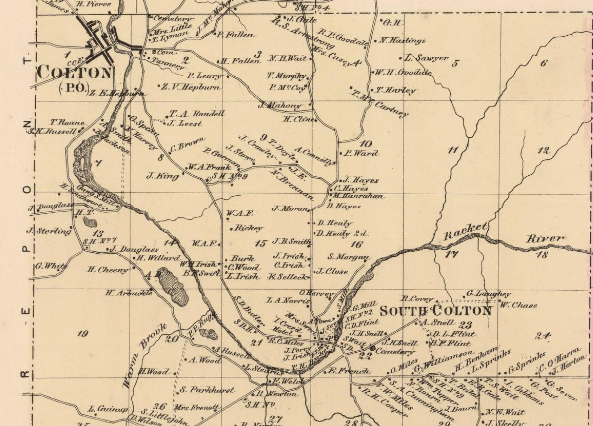 1865 Map. The "Racket" River before the dams created Higley Flow. 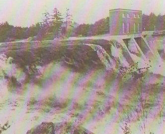 Floating Island going over the dam
|
In
1912, the first 46 foot high dam was built at Higley, creating the lake
and flooding the pastureland vegetation. In later years, as the
vegetation
began to break free, they formed huge 'floating islands' which created
problems for the power company as they went into and over the dam.
Eventually, crews were hired to cut up the 'islands' to reduce the size
to manageable levels. During winter, they spent countless hours
sawing the acres of bog into sections which were chained until
spring. Fortunately, the spring of 1943 was the highest water
that the Raquette had seen in decades and allowed the islands to be
floated over the top of the dam.
|
|
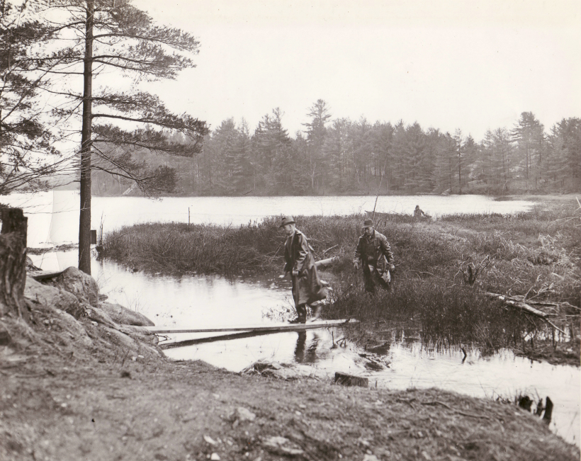
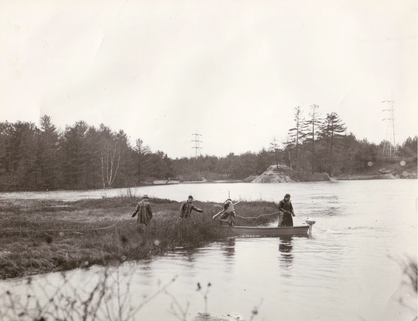 Men working for Niagara Mohawk Power Company trying to maneuver a "floating island" into the main channel at Higley Flow, between Colton and South Colton. 1942. Photo: Colton Historical Society |
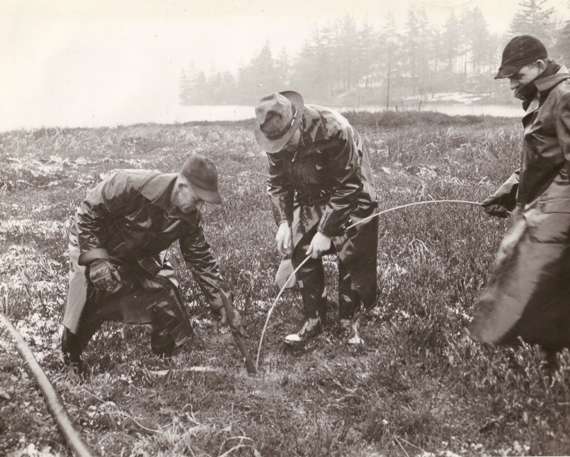 Niagara Mohawk Power Company workers attaching cables to "Higley's Floating Islands." Photo: Colton Historical Society |
|
 |
 |
|
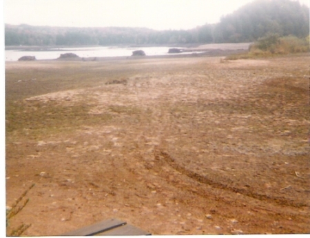
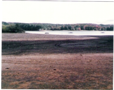
| Some of the old stone cribs that supported the cables to hold back the floating islands in Big Bay. | Photos taken during the dam repair in 1985. Thanks to Clark Trerise, who's grandparents, Cora & Sam McEwen, originally owned the property. | |
 |
 |
|
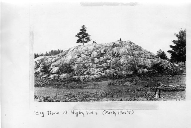
| August 2011: Clark just sent in this
eary shot of Big Rock, photographed about 100 years ago. (Thanks once
again, Clark!) |
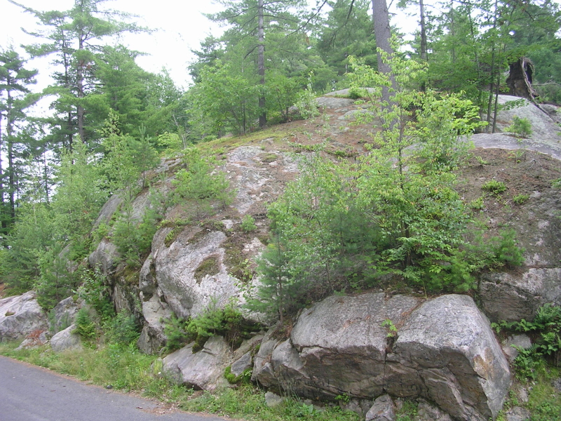
And,
here's how Big Rock looks today. A bit more folage, but some
things don't change. |
|
2 >> |